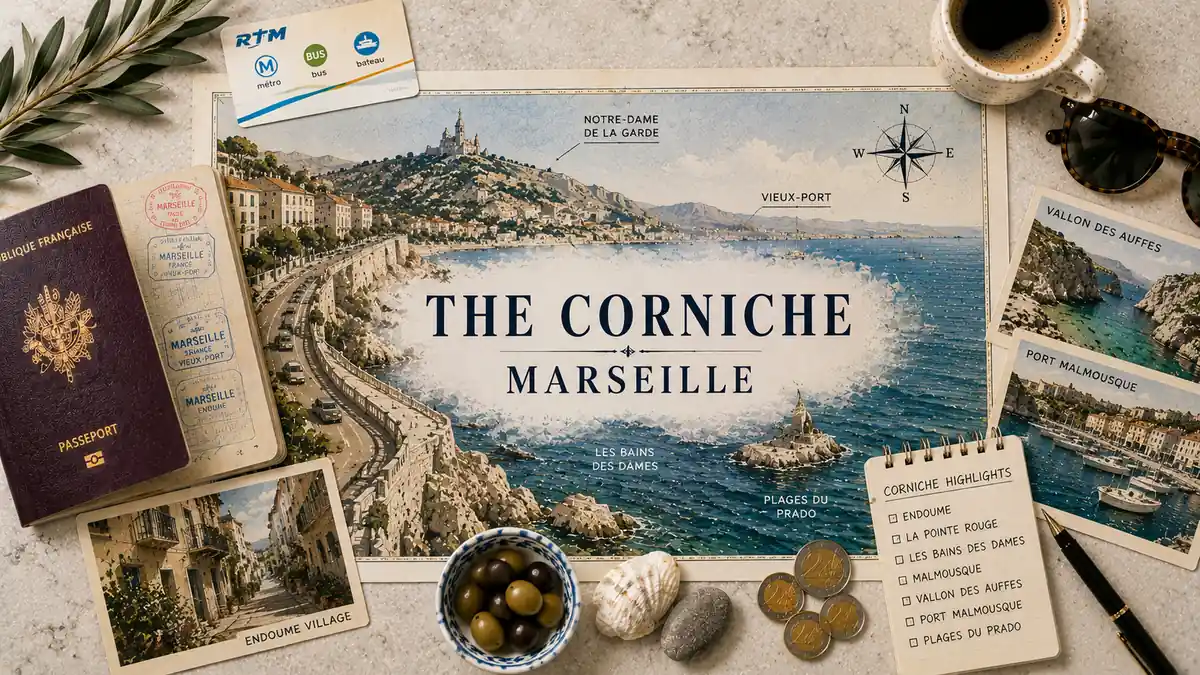
The Corniche is a coast road, and that is the first thing to get straight about it. It runs along the shore of Marseille’s 7th arrondissement, roughly three and a half kilometres of open sea on one side and the city climbing away on the other. The name and the distance are the easy part.
The stretch is more than the road. One street behind the boulevard sits Endoume, a residential quarter that still behaves like a village, and above both the slopes climb steeply towards the Notre-Dame de la Garde ridge. That layering is what being here actually feels like: a view with a working neighbourhood behind it. This guide stays on the stretch — what is strung along it, what Endoume is, how the place moves through the day, and where it begins and stops.
Quick Answer
The Corniche is Marseille’s seafront boulevard: a coast road running roughly three and a half kilometres along the 7th. It is two places at once — the panoramic seafront, and Endoume, the quieter village one street behind. It suits travelers who want sea air and slow evenings; anyone wanting the city at the door will feel the distance.
Trust Layer
Tripstou stay guide for travelers choosing where to base. Covers area atmosphere, budget, convenience, noise, and traveler fit.
Produced with AI assistance and reviewed by Alex Perrut, working in tourism since 2015, for the Tripstou editorial team. See our editorial process for details.
Last factual review: August 14, 2026.
Official sources consulted: France.fr, Atout France.
Key Takeaways
- The Corniche is a coast road along the 7th, running roughly three and a half kilometres between beaches at either end.
- It is two places at once: the panoramic boulevard on the water, and Endoume, the residential village one street inland.
- Almost everything worth stopping for — the ports, the coves, the flat rock — sits below road level, reached on foot.
- Nothing behind the boulevard was ever widened, which is why the village kept the scale it had before the view became famous.
- The seafront fills through the evening and empties once the light goes, leaving the quarter behind it residential and quiet.
- The stretch rewards travelers who want sea air and slow evenings, and frustrates anyone who wants the city at the door.
Table of Contents
What Is the Corniche in Marseille, Exactly?
The Corniche is a coast road along the shore of Marseille’s 7th arrondissement. It runs roughly three and a half kilometres from the Catalans beach to the Prado beaches, sea on one side and the city climbing away on the other. Everything else about the place follows from that geography.
The road explains its own shape. It was cut in 1863 as a narrow path along a rocky shore, then widened into the panoramic boulevard it is now roughly a century later. That gap between the two works is why the driving lanes, the seaward pavement and the wall above the water feel deliberately engineered, while almost everything hanging off them below does not.
Its full name is the Corniche du Président John Fitzgerald Kennedy, which maps and signage usually shorten to Corniche Kennedy. Locally it is just the Corniche, and the shortening tells you something true about the place: the road is the reference point for a whole slice of coast, not only for itself.
The ports and coves came first. Vallon des Auffes was a working fishing shelter long before anything was built above it, and the huts and cabins scattered around the coves further south predate the boulevard as well. The Corniche was laid across a coast that was already inhabited, which is why the stretch reads as a road passing over older places instead of a road that created them.
This page stays inside the 7th and on this stretch of coast. How Marseille as a whole fits together — its districts, its scale, what the city is actually for — belongs to the wider Marseille travel guide.
One Road, Three Layers: Seafront, Village, Slopes
The Corniche is three places at once: a seafront boulevard, a village behind it, and slopes above. Marseille’s tourist office treats Endoume and the Corniche as districts in their own right. The difference between the three is the whole character of the area, and it is what most descriptions of the Corniche miss.
The first layer is the boulevard itself, and it is the one everybody pictures. Wide pavement on the seaward side, a low wall, the near-continuous bench, traffic moving through in both directions, and light coming off open water for most of the day. It is a working road with a spectacular edge, and it never stops being a road.
The second layer begins about one street inland, where the scale drops immediately. Endoume’s lanes are narrow, residential and built to a size the boulevard never imposed on them, because they came from a different century of the same coast — modest fishing and customs dwellings first, then the bastides that wealthier residents put up once the road had been cut and the view became reachable. A village survived behind a panoramic boulevard, and the reason is simply that the boulevard took the shore and left the hill alone.
The third layer climbs. Behind Endoume the ground rises steeply towards the Notre-Dame de la Garde ridge, and the named routes up — montée des Croquants, chemin du Roucas Blanc — are genuine climbs, not gentle inclines. The climb starts almost immediately. Address by address, the gradient decides whether you have a sea view, and how much you pay for it in effort each time you come home.
The layers sit one street apart and feel a generation apart: the boulevard belongs to the traffic and the view, and the lane behind it belongs to whoever lives there. Part of why the split holds so cleanly is that this is a coast road the metro never reached — the stretch stayed slightly apart from the city’s daily machinery, and it still feels it.
Along the Stretch, from the Catalans to the Prado
The stretch is strung with a beach at each end and a run of ports, coves and rock in between. Between them sit a fishing port in a cleft under a bridge, a peninsula of huts and cabins, an old city beach, a war memorial, and a bench that runs almost the whole way.
Les Catalans marks the northern end — a small sand beach set in a bowl of rock below the Pharo headland, where the built city finally gives way to open coast. It is the point at which the road becomes a coast road and stays one.
Vallon des Auffes sits in a cleft below the roadway and is the piece of the stretch people remember. Around fifty cottages ring a tiny natural harbour packed with working boats, and the Corniche crosses overhead on a bridge, so most people meet the port by looking down into it before they find the way in. The name comes from the rope-makers who once worked the fibres here. Fish restaurants line the water now, and they keep the port busy, which makes it both the most photographed and the least peaceful thing on the coast road.
South of the bridge the coast breaks into coves. The Anse de la Fausse Monnaie is the first of them, and the Malmousque peninsula beyond it is a knot of fishermen’s huts, coloured beach cabins and flat rock that Marseille uses as its own back garden. The water off here looks out to the Frioul islands and the Château d’If.
The Plage du Prophète, one of Marseille’s oldest beaches, sits further along the road, and above it the Monument aux morts de l’armée d’Orient — the Porte de l’Orient — faces the sea in pale stone. Running through all of it is the bench: a near-continuous line of seating along almost the entire length, and the reason people sit on the Corniche instead of only passing along it. At the southern end the Prado beaches open out, wide and flat with space behind them, and the coast stops feeling like a corniche at all.
Swimming here means understanding what the coves actually are. They are rock more often than sand, reached by short scrambling descents from road level, with small patches of sheltered water where the swell does not reach. Some have steps and railings; others have a worn path and nothing else.
Almost everything worth stopping for on this coast sits below road level, which is why drivers describe the Corniche as a view and walkers describe it as a place.
| Along the stretch | What is there | What it is like |
|---|---|---|
| Northern end | Les Catalans beach, below the Pharo headland | Sand in a bowl of rock where the road begins |
| Under the bridge | Vallon des Auffes, a fishing port in a cleft | Cottages and working boats below road level |
| The middle coves | Anse de la Fausse Monnaie and the Malmousque peninsula | Huts, cabins and flat rock, with islands offshore |
| Past the coves | Plage du Prophète and the Porte de l’Orient memorial | An old city beach under wide open sea light |
| Southern end | The Prado beaches, where the boulevard opens out | Wide and flat, far less enclosed than the coves |
Endoume Is a Village That Kept Its Own Scale
One street behind a panoramic boulevard, Endoume still behaves like a village, and that contrast is the area’s real character. Its lanes are residential and quiet, built at a scale the Corniche never imposed on them. The seafront is the address; Endoume is the neighbourhood.
Endoume sits between the Pharo and Les Catalans to the north, Saint-Lambert and Bompard inland, with the Malmousque peninsula at its western edge. It has two spines and they do different jobs: rue d’Endoume runs inland through the quarter as its working street, and the Corniche runs along the water as its seaward one. Most of what makes the place liveable happens on the first.
The building stock tells the same story as the road. The older, plainer houses were put up for fishing and customs families who worked this coast, and the larger 19th-century bastides came afterwards, built by people who wanted the view once the Corniche had made it easy to reach. Both are still standing on the same lanes, often within sight of each other, which is why the quarter looks mixed in a way planned neighbourhoods never do.
Day to day the streets run on local business — deliveries, school runs, cars wedged onto the slope. Quiet here means residential, not empty: the lanes carry low footfall after dark because people live on them and the through-traffic is all down on the boulevard. It is a lived-in quarter that happens to have a spectacular street at the bottom of it.
Nothing behind the boulevard was ever widened for anyone. The lanes still run at their original width, the corners still turn where they always did, and the quarter kept the proportions it had before the view became famous.
How the Corniche Moves Through the Day
The Corniche runs on a daily cycle: swimmers early, traffic by day, the bench at dusk, empty pavements after. The seafront and the streets behind it move on different clocks. By late evening the boulevard is a road with a view and the quarter behind it is residential and still.
Mornings belong to the water. Swimmers come down into the coves early, runners take the pavement while it is empty, and the bench is largely unoccupied at the hour when the light off the sea is at its best. The road is already moving, because it is a through-route for a whole side of the city and always has been.
By the middle of the day the stretch is doing two jobs at once. Traffic runs the length of it, buses run the length of it, and the seafront fills with people who came specifically to be on it. On a warm weekend that gets serious: the coves, the beaches at both ends and every metre of bench absorb a large share of Marseille wanting the sea, and the pavement stops being easy to walk quickly.
The evening is what the stretch is really for. The bench fills, the light goes long and low over open water, and the pace on the pavement drops to something closer to standing still. Then it empties. Once the light is gone, footfall falls away fast — Vallon des Auffes stays lit and occupied because of its restaurants, and most of the rest of the coast road returns to being residential and quiet.
An off-season weekday is a completely different place. The seafront belongs to locals, dog-walkers and the sea, the coves are largely unpeopled, and the road is simply a road. The stretch has two populations that barely overlap: the city comes down for the water on warm afternoons, and the people who live here get the bench back by the time the light goes.
Can You Walk the Whole Corniche?
Yes — the Corniche is walkable end to end on a continuous seafront pavement. It runs roughly three and a half kilometres from the Catalans beach to the Prado beaches, which is the better part of an hour at a walking pace and longer if you stop. Walking is the way to understand the stretch.
The walk is seafront for nearly all of it, which is unusual for a road doing this much traffic. The pavement stays on the water side, the wall stays low enough to see over, and the bench — laid along the wall in the 1960s and near-continuous along almost the whole length — means you are never more than a short distance from somewhere to sit. It is flat. That is the part people underestimate about the road itself.
What is not flat is everything off it. Each cove and port sits below road level, so every drop down to Vallon des Auffes, the Fausse Monnaie or the rocks around Malmousque is a climb back up to the pavement, and if you turn inland instead you are immediately onto the steep lanes behind Endoume. The length is not what makes the walk long. The descents and the climbs back are, and they are also the reason the walk is worth doing at all.
It is an exposed coast road and the weather is felt on it, in both directions — glare and heat off the water on still days, wind straight into you on rough ones. On occasional Sundays the road is handed over to walkers and cyclists instead of cars, which changes the walk entirely for a day.
Where Does the Corniche Start and End?
The Corniche begins at Les Catalans beach in the north and ends at the Prado beaches in the south. It also has a third edge, upward, where the Roucas Blanc slopes climb away towards the Notre-Dame de la Garde ridge. Each edge changes what the place is.
The northern edge is where the city hands over to the coast. Walking out from the centre, the coast road begins at Les Catalans about a quarter of an hour on foot past the Pharo, and the change is immediate: built frontage on both sides gives way to sea on one side only. Looking back along the water, the harbour sits at the far end of that walk, and that is all the northern edge is — the point where the coast starts.
The southern edge is softer and easier to miss. The road opens out onto the wide Prado beaches, the rock and coves stop, the sense of being on a ledge above the water disappears, and the stretch quietly stops feeling like the Corniche well before any official boundary.
The upward edge is the one that defines the area most. Turn inland anywhere along the stretch and the ground rises through Endoume and Bompard onto the Roucas Blanc slopes, up montée des Croquants and chemin du Roucas Blanc towards the basilica ridge. The Corniche’s real boundary runs vertically: you leave the stretch the moment you turn inland and start climbing, long before you reach either beach.
Access along the stretch is straightforward and consistently road-based. Buses run the length of it, and this is a coast road the metro never reached — which is part of why it feels apart from the rest of the city rather than plugged into it. If what you actually want to settle is centre or sea, that decision is taken properly in Vieux-Port vs Corniche.
The edges, direction by direction
- North: Les Catalans beach, below the Pharo headland.
- South: the Prado beaches, where the boulevard opens out.
- Above: the Roucas Blanc slopes rising to the Notre-Dame de la Garde ridge.
- Inland: Endoume first, with Bompard and Saint-Lambert beyond it.
Who the Corniche Suits — and Who It Will Frustrate
The Corniche suits travelers who want sea air, a balcony over the water and slow evenings. Anyone who wants a city outside the door will feel the distance every time they go anywhere. That split is the whole fit question for this stretch, and it does not soften with time spent here.
The view is the thing the stretch sells, and it is a view you have to come home to, because almost everything else in Marseille is a journey away from it. That is the trade in one line. Whether it is the right base at all is a separate question from what the place is like, and the full weighing of Marseille’s areas against each other sits in the guide to where to stay in Marseille.
Fit varies enough by traveler that the stay pages carry those decisions individually. Couples tend to get the most out of the stretch, and the case is made in the guide to staying in Marseille as a couple. Families find the coves and the beaches at both ends easy and the slopes behind considerably less so, which the family base in Marseille guide weighs properly. First-time visitors usually want more city than this stretch puts within reach, and the first-time base in Marseille guide explains why.
Two kinds of traveler should look elsewhere before booking anything here. If your evening genuinely starts late, this is the wrong quarter and a base near the late-night city is the honest answer. If you are counting every euro, staying in Marseille on a budget looks well beyond the seafront. And if the sea view is the entire point, high-end and sea-view stays in Marseille and the shortlist of luxury hotels in Marseille do the property work this page deliberately leaves alone.
Hotels and places to stay
Compare hotels, apartments and stays for your dates in one search.
Search hotels and stays on hotels.com →
Tripstou may earn a commission if you book through this link, at no extra cost to you.
Frequently Asked Questions
What does the word “corniche” actually mean?
A corniche is a road cut along the face of a coast or cliff. Marseille’s is the literal thing: a carriageway carved into rocky shore, with the sea dropping away on one side and the city climbing on the other. The name describes the engineering, and locals then applied it to the whole slice of coast around the road.
Why is it called the Corniche Kennedy?
Because its full name is the Corniche du Président John Fitzgerald Kennedy, given after the American president’s assassination. Maps and street signs shorten it to Corniche Kennedy, and locals shorten it further to the Corniche. The road itself is far older than the name — it was cut along this shore long before.
Is Endoume the same place as the Corniche?
No — they sit one street apart and are treated as separate districts. The Corniche is the coast road and the frontage along it; Endoume is the residential quarter directly behind, running inland from rue d’Endoume. The two names are often used for the same area, but the boulevard and the lanes behind it are different places to be.
Is the bench on the Corniche really the longest in the world?
It is widely described as the longest bench in the world, though rarely verified. The claim circulates in guides more often than it is checked. What is certain is the effect: a near-continuous line of seating runs almost the whole length of the road, and the Corniche’s evenings happen on it.
Is the Corniche closed to cars on Sundays?
Not every Sunday, but roughly one a month. Under the city’s “La Voie est Libre” programme the Corniche is handed over to pedestrians and cyclists for the day, and traffic is kept off the seafront stretch. Dates shift from one edition to the next, so it is not something to build a visit around.
Is the Corniche worth visiting, and how long do you need?
Yes, and a slow half-day covers it properly. Walking the full stretch takes the better part of an hour at a steady pace, but the point is the drops off the road into the coves and the port, which is where the time goes. Stay on the stretch and it becomes ambient: the view you come home to.
Related Guides
- Where to stay in Marseille — every area weighed against the others, with the base decision resolved.
- Vieux-Port vs Corniche — the centre-or-sea decision, taken side by side.
- Marseille travel guide — how the whole city fits together beyond the coast road.
- Staying in Marseille as a couple — the base logic when the trip is for two.
- Marseille for first-time visitors — where to base on a first trip to the city.
- Best luxury hotels in Marseille — the property shortlist at the top end.
Did this guide save you time or money? Tripstou is independent and reader-funded — if you'd like to give something back, you can support the site with a crypto contribution of any size.