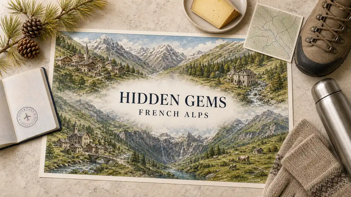
Most French Alps trips get anchored on the same handful of names, and by August the valleys around them are the busiest mountain ground in Europe. This page is the other list: villages, valleys and small towns that hand you the same walls, water and stone without the queue underneath them. Every pick is somewhere you can sleep, walk out of and eat in — never a spare ski resort with a shorter lift queue.
The picks are grouped by massif and valley, north to south, because that is how you add one to a real route: a gem only helps if it sits on a road you were already going to drive. Each entry names the valley it belongs to, why it stayed overlooked, who it suits and how hard it is to reach — including the honest cases where a car is the only sensible answer.
Quick Answer
The strongest hidden gems in the French Alps are high-valley villages, not quiet ski resorts. Saint-Véran in the Queyras and Névache in the Clarée lead the list, and the first choice is north versus south — greener Savoie or the higher, drier Hautes-Alpes. Rail travelers should start with Conflans; dead-end valleys reward a car.
Trust Layer
Tripstou selection guide for travelers choosing between multiple places. Covers selection criteria, traveler fit, and trip value.
Produced with AI assistance and reviewed by Alex Perrut, working in tourism since 2015, for the Tripstou editorial team. See our editorial process for details.
Last factual review: August 22, 2026.
Official sources consulted: France.fr, Atout France.
Key Takeaways
- Saint-Véran and Névache top the list because both kept intact village cores that no resort development ever reshaped.
- Settle north versus south first: Savoie is greener and easier to reach, the Hautes-Alpes higher, drier and remoter.
- Almost every pick here stayed quiet for the same reason: the road either ends or crosses a seasonal pass.
- Conflans above Albertville is the cleanest no-car pick — a walk uphill from a station on the Tarentaise line.
- Expect thinner services the higher you drive — fuel, shops and dinner get sparse at the head of these valleys.
- None of these picks is a smaller ski resort; each earns its slot as a village with its own centre.
Table of Contents
What counts as a hidden gem in the French Alps?
A hidden gem here is a village or valley the crowds skip — not a smaller ski resort. It has its own centre, its own reason to exist before tourism arrived, and a setting that would draw traffic if it sat two valleys west. Scarcity of visitors is the test, not scarcity of lifts.
The famous names are the contrast on this page, never the picks. Chamonix, Annecy, Megève, Courchevel, Méribel, Val d’Isère, Tignes and Alpe d’Huez are excellent at what they do, and they are judged on their own terms among France’s famous destinations. Everything below was chosen because it delivers a comparable setting to a fraction of the traffic.
If you are not locked to the mountains, the same famous-versus-quiet axis runs across the whole country in our list of hidden gems across France. This page stays inside the Alps and works north to south, from the shore of Lake Geneva to the Italian frontier ridge above the Queyras.
The north-south split is the first decision to settle, and it does more work than any individual pick. The northern half — Haute-Savoie and Savoie — is greener, wetter and lake-fed, with pasture, dairy valleys and Mont Blanc dominating the skyline. The southern half, essentially the Hautes-Alpes, is higher, drier and markedly sunnier, and its villages sit at altitudes the north reserves for lift stations. Northern picks are gentler and easier to reach. Southern picks are wilder and cost you a mountain pass.
If beauty alone is your criterion, four entries carry it on architecture: Conflans above Albertville, Saint-Véran in the Queyras, Bonneval-sur-Arc at the head of the Maurienne and Névache in the Clarée. Each keeps a preserved core with no modern sprawl bolted on. France’s village-beauty registers revise their membership over time, which makes a listing a weaker signal than it looks. What you can judge on arrival does not move: the stone, the setting and the absence of new building.
What disqualifies a place from this list:
- A ski resort that is simply smaller, cheaper or quieter than its neighbour.
- A quiet quarter of a famous town — this page is about places, not corners.
- Anything outside the Alps proper, however Alpine it photographs.
- The Provence-facing valleys south of the Hautes-Alpes, which are a different climate and a different list.
In the Alps a place stays quiet because of its road, not its looks. The tarmac ends there, or it climbs a pass that shuts for months. That single mechanism explains almost every pick below — and it is also why the best of them cost you a detour that a lift-served resort never would.
Chablais, Léman shore and the Giffre: quiet villages near Lake Geneva
Nernier is the quiet find on the French shore of Lake Geneva, an easy first night from Geneva. This is the gentlest cluster on the list: lakeshore lanes, dairy valleys and pre-Alpine pasture, with altitude arriving slowly as you climb the Dranse and the Giffre. Access is the easiest on this page.
The cluster suits travelers who want mountains as scenery instead of as a project, and it is the obvious choice for a first or last night built around an international airport. The tradeoff is altitude: nothing here has the scale of the southern picks, and the high-mountain drama sits a long way further south. What you gain is a cluster you can reach on the day you land.
What you would actually fill those days with — here and in every valley below — belongs to our guide to things to do in the French Alps, which handles the experience side that this shortlist deliberately leaves alone.
Nernier and the Léman shore
Nernier is a stone hamlet on the French shore of Lake Geneva that never turned itself into a promenade. A handful of lanes drop to a small harbour, the shore stays wooded instead of built up, and the Swiss side sits across open water. What separates it from the other lakeside villages is scale: it is small enough to cross in minutes and quiet enough that the lake, not the village, is the event. Yvoire, a short drive along the same shore, is the honest comparison — beautiful, heavily promoted and genuinely crowded all summer. Nernier gives you the same water and the same light with the coaches parked somewhere else.
Getting there: the simplest arrival on this page — a short lakeside drive from Geneva, with no pass, no altitude and no seasonal road to worry about.
Pick this if: you want Lake Geneva’s light and a swim without the summer coach traffic.
Abondance and its valley
Abondance sits in the valley climbing behind the Léman shore, a farming commune built around an old abbey and its cloister. The valley is dairy country first and a visitor destination second, which is exactly why it still reads as lived-in: working farms, scattered hamlets and a road that carries on towards the Swiss border above. What distinguishes it from the lakeside picks is that the mountains genuinely begin here — slopes rise straight out of the pasture instead of sitting on the horizon. It is also the cluster’s best answer for travelers who want a base with a working life of its own, not a season.
Getting there: valley road up from the lake shore, no high pass on the approach, which keeps it usable well outside high summer.
Pick this if: you want a lived-in dairy valley where the slopes rise straight out of the fields.
Sixt-Fer-à-Cheval and the Giffre
Sixt-Fer-à-Cheval sits at the head of the Giffre valley, where the road runs out against a horseshoe of cliffs and waterfalls. The cirque is the reason to come and it does the work a cable car does elsewhere: the whole scale of the place is visible from the valley floor, on foot. The village behind it stayed a village — an old core of stone and timber that never converted into a station, with Samoëns lower down as the town you drive through to get here. That combination is what makes it the northern cluster’s most dramatic pick: high-mountain setting, low-mountain access.
Getting there: a single valley road up the Giffre from Samoëns; easy driving, and the closest this page comes to alpine scale without crossing a pass.
Pick this if: you want a road that ends in an amphitheatre of cliffs and waterfalls, with a village that stayed a village.
Beaufortain and the Tarentaise fringe: the villages the mega-resorts overlook
Between Mont Blanc and the Tarentaise resorts sit villages the lift traffic drives straight past. The Beaufortain is cheese and pasture country with old hamlets and a high lake road; the Tarentaise fringe holds parish villages below the busiest ski real estate in Europe. All of it is reachable by road from Albertville.
The Beaufortain is the anomaly on this page. It is a rural massif of pasture and hamlets, ringed by mountains people cross continents to reach, and still barely visited in its own right. The explanation is that it never built the lift network that would have put it on the map, so it kept the farms — and the farms are the reason to go.
The Tarentaise fringe works the other way round. These are old villages that the ski industry grew around without absorbing, so they sit within sight of enormous development while keeping their own centres. Judge them as villages. The moment a pick has to be argued through its lift system, it belongs on a different page.
Arêches-Beaufort and the Beaufortain
Arêches-Beaufort is a two-village commune of roughly 2,100 residents, with Arêches sitting at 1,080 m above Beaufort on the valley floor. It made the list as the clearest cheese-country case in the Alps: Beaufort is produced here, and the high pastures that feed it are the landscape you have come to look at. Boudin, the hamlet on the slope above Arêches, is the architectural draw — timber and stone stacked up a gradient that looks unbuildable. Higher again, the road to Lac de Roselend crosses some of the most spectacular open ground in Savoie. The ski area is not the argument here. The valley is.
Getting there: road access from Albertville all year. The Cormet de Roselend and the Col du Pré are normally shut through winter and open from late spring to early summer — check the road operator before routing a trip through them.
Pick this if: you want cheese country, hamlet architecture and a high lake road, with Europe’s busiest resorts one valley away and entirely ignorable.
Sainte-Foy-Tarentaise
Sainte-Foy-Tarentaise is the Tarentaise village that the traffic passes without slowing down. It sits on the valley road above Bourg-Saint-Maurice, between the railhead and the two names everybody is driving towards — Val d’Isère and Tignes — and it kept old hamlets of stone and timber on the slopes above the road. Position is what distinguishes it: nowhere else on this list puts you this close to the mega-resorts while feeling this uninvolved with them. It also makes the substitution case more cleanly than anything else here. Same valley, same mountains, completely different evening.
Getting there: the Tarentaise valley road above Bourg-Saint-Maurice, the region’s railhead; no pass on the approach, so the road works in every season.
Pick this if: you want a Tarentaise address without the Tarentaise crowd, minutes from names you are deliberately not staying in.
Saint-Martin-de-Belleville
Saint-Martin-de-Belleville is the old village on the floor of the Belleville valley, below the purpose-built resorts higher up the same road. Stone houses, slate roofs and an old church square survive intact, which is genuinely unusual this deep inside a developed ski system. Its distinction on this page is the proximity of opposites: a Savoyard village with its original shape, sitting inside one of the most heavily engineered valleys in the Alps. That makes it the softest landing for travelers arriving with people who do want the big infrastructure nearby, while the village itself stays the reason to book.
Getting there: the valley road climbing from Moûtiers; low enough to stay open all year, with no pass crossing required.
Pick this if: you want village stone and a church square inside a valley everyone else visits for its slopes.
Conflans, above Albertville
Conflans is a walled medieval village on the hill directly above Albertville, and it is the easiest pick on this page by a wide margin. Arcaded streets, a fountain square and a gate through the ramparts sit a short climb above a modern valley town that most people know only as somewhere to pass through on the way up. It earns its slot because it is the one entry here you can reach, walk and enjoy with no car and no mountain road at all. What it does not give you is altitude — this is medieval Savoie at valley level, and the high villages are still a long climb above it.
Getting there: on foot from Albertville below, which sits on the Tarentaise rail line; no car needed at any stage.
Pick this if: you are arriving by train and want a medieval village you can walk up to from the station.
Haute-Maurienne and the Vanoise: Savoie’s quietest high valley
The Haute-Maurienne trades resort convenience for the quietest stone villages in Savoie. The upper valley ends at a pass that is normally shut through winter, the Vanoise National Park takes up much of the ground above it, and heavy development never arrived as a result. Modane, lower down, is the valley’s railhead.
Two forces kept this valley as it is. Protection came early over the high ground, and the road stops being a through route for a large part of the year. A valley that leads nowhere in winter does not attract the investment that reshapes a place, so the villages kept their proportions.
The honest tradeoff is distance and thin services. The Maurienne is long, the best villages are at the far end of it, and shops, fuel and restaurants get sparser the higher you drive. This section stays deliberately short: it is a cluster to choose on character and solitude, and anything more specific about seasons or opening should be checked with the villages themselves before you commit.
Bonneval-sur-Arc and Bessans
Bonneval-sur-Arc sits at the head of the Arc valley, the last village before the road climbs to the Col de l’Iseran. Its case is architectural: a compact core of stone and slate that stayed intact because nothing modern was built around it. Bessans, on the flatter valley floor below, is the same idea with more space and more sky above it. Both suit travelers who read remoteness as a feature and not a complication. Both also ask you to accept the consequences — the valley is long, the drive up is part of the experience, and the road beyond stops being an option for much of the year.
Getting there: the valley road above Modane, the Maurienne’s railhead. The Col de l’Iseran link to the Tarentaise is normally closed through winter and opens from late spring to early summer, so confirm with the road operator instead of assuming a through route.
Pick this if: you want the last village before the pass and accept a long drive to reach it.
Aussois and Termignon/Val-Cenis
Aussois sits on a sunny shelf above the Maurienne valley floor, on the edge of the Vanoise National Park, and it is the practical way into this cluster. The park boundary above these villages is the reason the upper Maurienne never developed the way the Tarentaise did — protection arrived before the building did. Termignon and Val-Cenis, further up the valley, follow the same pattern on a slightly larger scale. What distinguishes this pair from Bonneval is usability: you are still in a stone village, but closer to the valley’s services and its railhead, and the drive in is considerably shorter.
Getting there: a short climb off the Maurienne valley road above Modane; no pass crossing needed to arrive, which keeps the cluster reachable outside the summer pass season.
Pick this if: you want Vanoise-edge quiet from a village that still works as a base, without driving to the head of the valley.
Oisans, Écrins and the Vercors: wild valleys without the resort machine
These valleys deliver the biggest mountain walls on this list with the least infrastructure. La Grave faces La Meije across the valley, the Écrins gateways sit at the mouths of long glacial side valleys, and the Vercors trades altitude for limestone plateau and forest. Small working villages, not resorts, carry all three.
The cluster suits travelers whose main criterion is landscape scale. Nothing here has been designed to entertain you: the villages are small, the roads are the roads that farms needed, and the mountains are the largest on this page. That is the appeal and the limitation in one sentence.
It also spans two very different temperaments. The Écrins side is severe — high rock, glacier and long approaches. The Vercors is pastoral, forested and much gentler underfoot, which is why it carries the family case for this cluster rather than La Grave.
La Grave, facing La Meije
La Grave is a working village strung along the road below La Meije, one of the great faces of the Écrins, and that wall is the entire reason to come. Nothing here was laid out for visitors: the houses climb the slope in whatever order the terrain allowed, and the view is simply what the village happens to point at. What sets it apart from every other pick is the imbalance between mountain and settlement. The massif is enormous, the village is tiny, and the effect is closer to a base camp than a holiday address. Services are limited and that is part of the deal.
Getting there: on the road up the Romanche valley towards the Col du Lautaret. High crossings in this corner are weather-dependent — check conditions before committing to one.
Pick this if: you want a mountain face filling the window and can live with one road, one village and few services.
Vallouise and Le Monêtier-les-Bains
Vallouise is the southern gateway into the Écrins, sitting where glacial side valleys converge on a village that still farms. Le Monêtier-les-Bains, over in the Guisane valley, adds thermal springs to the same equation — hot water at the end of a day outside, in a village core that long predates the ski trade. What distinguishes this pair is that they combine Écrins-scale terrain with year-round village life, which the higher picks cannot promise. They are also the closest this list comes to comfort at altitude, and the natural choice for travelers who want wild country without a spartan evening.
Getting there: valley roads off the Durance and the Guisane, both within easy reach of Briançon; the approaches stay usable most of the year, though the high crossings between valleys do not.
Pick this if: you want an Écrins gateway with hot springs waiting at the end of the day.
Corrençon-en-Vercors
Corrençon-en-Vercors sits at the southern edge of the Vercors plateau, where the ground is limestone, meadow and forest instead of glacier and rock wall. It is the gentlest entry in this cluster and the strongest family pick on the page: compact village, easy terrain underfoot, short drives, and a nature reserve on the doorstep. Temperament is what separates it from the Écrins picks — the Vercors is a plateau, so the landscape opens out around you where the Écrins closes in above you. Families who find high valleys intimidating usually find this one immediately readable.
Getting there: up onto the plateau from the Grenoble side; the plateau roads are winding but low by Alpine standards, and no pass is involved.
Pick this if: you have children and want easy plateau ground under everyone’s feet.
The Écrins are where the mountain outgrows the village’s ability to look after you. Arrive with a full tank and a dinner plan, because both run out earlier here than the map suggests — and that, more than the scenery, decides whether you enjoy the cluster or endure it.
Briançonnais and the Clarée: Névache’s slow dead-end valley
The Clarée is the Hautes-Alpes valley that kept its villages and lost the traffic. Névache and Val-des-Prés hold the valley floor, larch forest and meadow climb from the river, and the road simply ends. Briançon’s fortified upper town guards the valley mouth below.
Two things preserved the Clarée: it leads nowhere, and much of it is protected. A valley that crosses to somewhere else collects traffic whether it wants it or not; a valley that stops collects only the people who chose it. Add protected status over most of the ground and there is no mechanism left by which a resort core could appear.
Briançon at the mouth changes the practical picture entirely. It is a fortified town and the end of the railway line in this corner of the Hautes-Alpes, which makes it the staging point for the Clarée above and the Queyras below — the rare case on this page where the useful base is also worth visiting for itself.
Névache, Val-des-Prés and the Clarée
The Clarée runs north from Briançon and stops, which explains most of its condition. Névache and Val-des-Prés are the two main villages — stone hamlets, meadows along the river, larch on both flanks — and the valley’s own tourist board describes some 20,000 hectares of protected nature here. The protection shows. There is no resort core, no ribbon of new building and no through traffic to speak of. The Vallée Étroite, reached over a high side road towards the Italian frontier, extends the same character and is weather-dependent to reach. This is the marquee southern valley on the page for a reason: it looks the way people imagine the Alps looked before lifts.
Getting there: Briançon is the rail terminus for this corner, with onward buses; the valley road climbs from there. Car access to the upper valley is regulated during the summer months — check the local operator before planning to drive to the end.
Pick this if: you want a dead-end valley of meadow, larch and stone hamlets, and are happy to leave the car below in high summer.
Briançon’s upper town and Mont-Dauphin
Briançon’s upper town is a walled quarter on a spur above the modern town, and Mont-Dauphin is a fortress village laid out on a flat rock terrace above the Durance further south. Both are military architecture at a scale the pasture villages cannot match: bastions, ramparts, gates and straight garrison streets, all of it still inhabited and in use. They belong on this list as the counterweight, proof that the southern Alps preserved stonework as well as scenery. For travelers who go flat after several days of pasture and peaks, this is the pair that resets the trip without leaving the mountains.
Getting there: Briançon is where the railway ends here, with buses onward into the valleys; Mont-Dauphin sits lower down the Durance road and needs no pass to reach.
Pick this if: you want fortified architecture and a working town as the built counterweight to all this pasture.
Is the Queyras worth going out of your way for?
Yes — the Queyras is the strongest cluster here if you want altitude, solitude and working villages. It is reached over high passes from the Briançonnais or up from the Durance, which is precisely why it stayed quiet. Walkers and slow travelers gain most; tight schedules lose hours on the approach.
The Queyras is a cluster, not a village. Saint-Véran, Ceillac, Molines-en-Queyras, Arvieux, Château-Ville-Vieille, Aiguilles and Abriès-Ristolas share one high basin between the Écrins and the Italian border, with Guillestre and the Guillestrois at the entrance. You arrive over the Col d’Izoard from Briançon, over the Col Agnel from Italy, or up the Guil from the Durance valley — and the first two are normally shut through winter, opening from late spring to early summer.
The cost is time, and it is worth naming plainly. Every approach is slow, the basin is enclosed, and moving in or out of it eats a substantial part of a day. In exchange you get the highest concentration of intact villages on this page, terrain that walkers rate against anywhere in the country, and a valley culture that never had to reorganise itself around visitors. For how a Queyras leg fits into the wider mountain trip — timing, basing and moving between valleys — the French Alps guide covers the planning side.
Saint-Véran
Saint-Véran is the Queyras headline: timber and stone stacked along a south-facing slope at 2,042 m, described by its own destination board as the highest village in Europe. Altitude here is not a marketing line but a design constraint — it shaped the architecture, the crops, the light and the temperature after dark. What separates it from everything else on this page is that nothing else comes close to this height while remaining an inhabited village with a working calendar. The tradeoff is honest and physical: thin air, steep lanes and genuinely cold nights, even in the middle of summer.
Getting there: by valley road up from Guillestre through the Guil, or over the Col d’Izoard from Briançon — the Izoard shuts for the winter and does not reopen until the snow clears.
Pick this if: you want the altitude headline and will trade comfort for it.
Ceillac
Ceillac occupies a side valley of the Queyras that ends in meadow and larch under high walls, and it is the calm alternative to Saint-Véran’s reputation. The village kept a farming core of chalets and old churches, and the basin around it does the rest — scenery arranged at close range instead of held at a distance. Its distinction is quiet even by local standards: fewer cars, fewer day visitors and almost none of the summer stopping traffic that the flagship village collects. It is the pick for people who want the Queyras experience without sharing the photograph.
Getting there: a short climb off the Guil valley road above Guillestre; no pass crossing to arrive, which makes it the cluster’s most reliable address outside the pass season.
Pick this if: you want the Queyras without its most-photographed address, in a valley that ends in meadow.
Abriès-Ristolas and the upper Guil
Abriès-Ristolas holds the far end of the Guil, where the valley runs out against the Italian frontier ridge and the road stops for good. This is the Queyras at its most remote, and standing here explains the whole cluster: beyond this point there is only border. The other villages fill in around it — Molines-en-Queyras and Arvieux on their own side valleys, Château-Ville-Vieille and Aiguilles strung along the Guil itself. Guillestre is the gateway you drive through, and Embrun on Serre-Ponçon is the lake town at the entrance. That is where this list stops; everything further south belongs to Provence.
Getting there: the Guil valley road from Guillestre, or over the Col Agnel from Italy — Agnel is a winter closure, usable only once the pass has reopened, so never build a route on it without checking first.
Pick this if: you want to drive to the end of a valley that stops at the frontier.
The Queyras repays nights, not days. The same passes that keep it quiet turn a day trip into mostly driving, and the valley’s best hours are the early ones, before the first cars come over the col.
Which hidden gems can you reach without a car?
A few picks work by rail — Conflans first — but most reward a car. Railheads sit at the valley mouths: Bourg-Saint-Maurice for the Tarentaise, Modane for the Maurienne, Briançon as the line’s terminus with onward buses. The gems sit up the side valleys above them.
Three cases genuinely work without a car. Conflans is the clean one, a walk uphill from Albertville. Briançon’s upper town works too, because the line ends in the town itself and the fortified quarter sits above it. The Léman shore picks work at a stretch, since that corner is the most developed on this list and the transfers from Geneva are short.
Everything else assumes a car, and the reason is structural. French Alpine railways were built up the main valleys to serve large resorts and industry; the villages on this page sit up the side valleys those lines never enter. That gap is exactly why the villages stayed quiet, so it is not a flaw in the list — it is the list’s defining condition.
Valley grouping is what makes the shortlist usable on a real route. The Briançonnais, the Clarée and the Queyras chain together on one southern loop from a single base. The Beaufortain and the Tarentaise fringe share the Albertville approach and combine easily on one run up the valley. The Haute-Maurienne connects to the Tarentaise only over the Col de l’Iseran, normally shut through winter — in the cold months those two clusters are a long way apart by road, whatever the map suggests.
| Valley cluster | Nearest railhead | Onward from the railhead | Who it suits |
|---|---|---|---|
| Chablais, Léman shore and Giffre | Lake Geneva shore, close to Geneva | Short transfers along the shore and up each valley | Travelers wanting water, pasture and easy arrival |
| Beaufortain and Tarentaise fringe | Albertville, then Bourg-Saint-Maurice higher up | Conflans on foot; every other pick by road | Rail arrivals plus cheese-country and hamlet hunters |
| Haute-Maurienne and the Vanoise | Modane, down in the valley below | Long valley road up to the high villages | Solitude seekers content to drive a long way |
| Oisans, Écrins and Vercors | Grenoble side of the massifs | Mountain and plateau roads, a car assumed | Big-wall scenery, plus families on the Vercors |
| Briançonnais, Clarée and Queyras | Briançon, where the line terminates | Onward buses, then valley roads and seasonal passes | Walkers wanting high villages and real solitude |
Distance is not the problem in the Alps; connection is. Two picks a few kilometres apart on the map can sit either side of a ridge, and joining them means a full mountain crossing over a pass that only opens for part of the year. Plan by valley, not by radius, and confirm any pass-dependent leg with the road operator before building a route around it.
Train and bus tickets
Compare routes, schedules and prices across rail and bus operators in one search, with mobile tickets on your phone.
New to Omio? Code NEW10 takes 10% off your first booking — or APPNEW10 if you book inside the Omio app. Both apply to bookings up to €80.
Search routes and compare prices on Omio →
Tripstou may earn a commission if you book through this link, at no extra cost to you.
Frequently Asked Questions
Are the Col de l’Iseran and Col d’Izoard open year-round?
No. Both are high mountain passes that normally close through winter and reopen in late spring or early summer, depending on snow. Check the road operator before routing a trip over either. In the closed months the Haute-Maurienne and the Queyras must be approached from their own valley floors instead.
Is the Queyras hard to get to?
Yes, by every route. The Guil valley road climbs from Guillestre; the alternatives are high passes from Briançon or Italy that stay shut for much of the year. Briançon is the nearest rail terminus, with buses onward, so budget most of a day for the arrival.
What is the difference between the northern and southern French Alps?
Altitude, climate and access. The north — Savoie and Haute-Savoie — is greener, wetter and lake-fed, with the easiest arrivals from Geneva and the Tarentaise railheads. The south, essentially the Hautes-Alpes, is higher, drier and sunnier, and reaching its villages usually means a pass or a long valley climb.
Which hidden gem is easiest to add to a Chamonix or Annecy trip?
Conflans, the walled village above Albertville, is the easiest addition from either. Albertville sits on the Tarentaise rail line and Conflans is a walk uphill from the town, so no car is needed. From Chamonix, the Léman shore picks — Nernier above all — are the shorter detour.
Can you combine the Queyras and the Clarée in one trip?
Yes, easily — they are the natural pair on this page. Both sit within reach of Briançon, the staging point for the Clarée above the town and the Queyras beyond the Col d’Izoard. When the pass is shut, reach the Queyras up the Guil from Guillestre instead.
Are these Alpine villages good for families?
Some are, and Corrençon-en-Vercors is the clearest family pick. The Vercors is a plateau of meadow and forest, with easy ground underfoot and short drives. The Léman shore works too, for water and gentle terrain. The high dead-end valleys ask for long drives and thin services.
Related Guides
These four guides take the shortlist further: planning the wider mountain trip, filling the days once you are in these valleys, seeing how the famous names compare, and finding the same quiet-versus-famous split across the rest of the country. Each answers a question this page deliberately leaves alone.
- French Alps guide — planning the wider trip: when to go, how long to stay and where to base.
- Things to do in the French Alps — what actually fills the days once you are in these valleys.
- Best places to visit in France — the famous destinations, judged on their own terms.
- Hidden gems in France — the same famous-versus-quiet axis across the rest of the country.
Did this guide save you time or money? Tripstou is independent and reader-funded — if you'd like to give something back, you can support the site with a crypto contribution of any size.