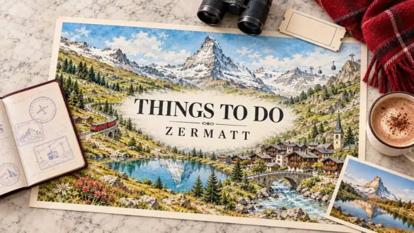
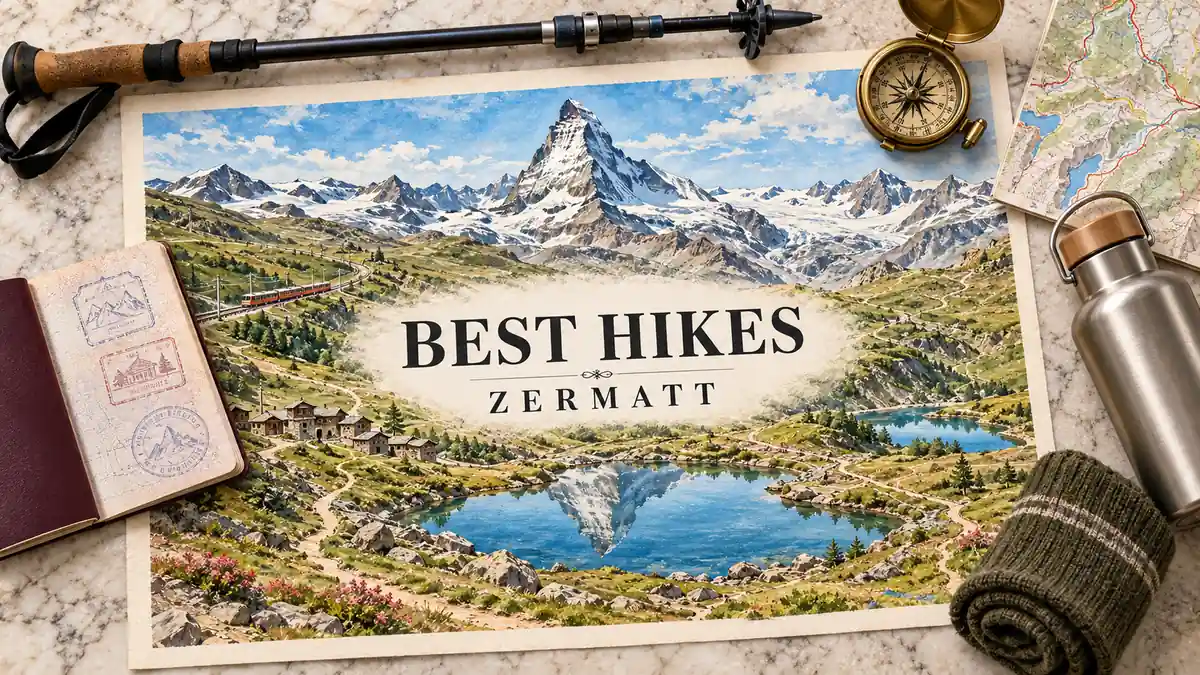
Zermatt’s best hikes are lift-served and point-to-point, so choosing one comes down to a single trade: how much effort you want to spend for the mountain view you want. A train or cable car does most of the climbing on the short trails. The hard ones make you earn every metre.
This guide sorts Zermatt’s day hikes by effort, from short downhill walks to hard climbs. Every pick names the lift that takes you up and the station where you come down, or says plainly when the trail climbs straight from the village. Each one ends with a single “Pick this if” line, so you can match a trail to your legs, your group and the weather on the day.
The Matterhorn is the payoff on almost every trail here. What changes from pick to pick is the angle: a mirror-calm lake, a glacier basin, or the foot of the ridge itself.
Quick Answer
The Five Lakes Walk is the best all-round Zermatt hike: moderate, lift-served and Matterhorn-facing for most of its length. For the view with the least effort, take the short downhill Riffelsee trail from Rotenboden; fit hikers with a head for heights pick the hard Hörnlihütte trail. Families do best on the Riffelsee or Gorner Gorge walks.
Trust Layer
Tripstou selection guide for travelers choosing between multiple places. Covers selection criteria, traveler fit, and trip value.
Produced with AI assistance and reviewed by Alex Perrut, working in tourism since 2015, for the Tripstou editorial team. See our editorial process for details.
Last factual review: October 2, 2026.
Official sources consulted: Switzerland Tourism, State Secretariat for Economic Affairs (SECO), Matterhorn Paradise, Zermatt Tourism.
Key Takeaways
- The Five Lakes Walk from Blauherd to Sunnegga is the best all-round Zermatt hike, with the Matterhorn in view from most lakes.
- For the Matterhorn reflection with the least effort, walk the short downhill Riffelsee trail from Rotenboden on an early train.
- The Hörnlihütte trail is officially rated Advanced, so it suits only fit, sure-footed hikers with proper boots and a head for heights.
- Families and cloudy days suit the Furi suspension bridge and Gorner Gorge walk, which needs no altitude and no clear view of the Matterhorn.
- Plan every Zermatt hike as a pair of stations: check which lift takes you up and which brings you back down.
- Lift-served trails depend on the summer lift season, roughly June to September, and the high trails are most reliable in July and August.
Table of Contents
How to Choose a Zermatt Hike by Effort
Downhill trails from a lift station are Zermatt’s low-effort Matterhorn wins; trails that climb are the hard ones. Most hikes here run from one station to another, so the real choice is which lift goes up, which comes down, and how many hours of walking sit in between.
Times are ranges from official trail data for walking only; lift rides come on top.
| Hike | Start → End | Time (range) | Effort | Matterhorn view |
|---|---|---|---|---|
| Riffelsee Trail | Rotenboden to Riffelberg on the Gornergrat Railway | About 1 hour of walking | Officially moderate, but short and almost all downhill | Full Matterhorn reflection in the lake |
| Furi bridge and Gorner Gorge | Furi cable car station or the village | A short half-day outing | Easy forest paths with no altitude | None needed, works under full cloud |
| Five Lakes Walk | Blauherd to Sunnegga, above the Sunnegga funicular | About 2.5 to 3.5 hours | Moderate, downhill overall with short climbs | Reflections and views from most lakes |
| Matterhorn Glacier Trail | Trockener Steg to Schwarzsee by cable car | Roughly 2 hours, walking downhill | Moderate, at high altitude throughout | The mountain and its glaciers up close |
| Hörnlihütte | Schwarzsee up to the hut and back | 4 hours or more round trip | Hard, officially rated Advanced by the operator | Standing at the foot of the ridge |
| Edelweissweg to Höhbalmen | Zermatt village up to the Höhbalmen balcony | A full day of hiking | Hard, a sustained climb with no lift | Wide balcony view across the Zmutt valley |
Plan every hike as a pair of stations. The lift that drops you at the start is rarely the one that brings you home, so check both ends before you leave the village. Finishing on a different line is normal here.
Each row down the table buys a closer mountain and fewer people, and costs more hours and more ascent. Altitude moves the effort more than distance on these trails. The Glacier Trail is shorter than the Five Lakes Walk yet feels harder, because the whole route sits above about 2,500 m, where breath runs short.
The lifts are also sights in their own right, but this page treats them as trail access only. If Zermatt is one stop among several and you are still choosing between Swiss regions, start with the best hikes in Switzerland.
The Short Hikes Give the Best Matterhorn View for the Least Effort
The two short picks are the Riffelsee trail from Rotenboden and the Furi bridge and Gorner Gorge walk. Both take little time and are mostly downhill or flat. Riffelsee is the Matterhorn pick; the gorge-and-bridge pair is the family pick, with no altitude to manage and no need for a clear peak.
On Riffelsee, timing decides the result more than fitness does. Arrive on an early train and the lake is usually still; by midday the reflection is often gone. Keep the gorge walk as plan B. It works when cloud sits on the summit.
Riffelsee Trail: Rotenboden to Riffelberg
Start: Rotenboden (Gornergrat Railway) · End: Riffelberg · Distance: about 3 km · Time: about 1 hour · Rating: moderate (official), almost entirely downhill
The Riffelsee trail is the shortest walk in Zermatt with the Matterhorn straight ahead. It is officially rated moderate, yet it lasts about an hour, barely climbs, and the tourist office lists it for children from 4. You leave the train at Rotenboden, drop a few minutes to the small lake, then follow a gentle path down through open pasture to Riffelberg, where you rejoin the railway for the ride back to the village.
Its payoff is the reflection. On a still morning the full pyramid of the Matterhorn sits upside down in the water, and the shoreline gives you several angles on it before the lake falls behind. No other pick delivers that frame for so little effort. Photographers come for first light.
Pick this if: you want the Matterhorn reflection with an hour of walking and no climbing.
Furi Suspension Bridge and Gorner Gorge: the Family Walk
Start: Furi (Matterhorn Paradise cable car) or Zermatt village · Route: forest paths, a suspension bridge over a gorge, then the gorge walkway · Time: a short half-day · Effort: easy
The Furi suspension bridge and the Gorner Gorge are two neighbouring short walks that combine easily into a half-day outing. Get off the cable car at Furi, its first station, and follow forest paths to the suspension bridge, where the river runs far below the deck. From Furi, paths continue down toward the village and the gorge.
The Gorner Gorge is a paid, seasonal walkway of wooden boardwalks along the rock walls just above the rushing water. It is the most dramatic stretch of the outing, and children love it. Neither part needs a clear sky or a head for altitude. This is the one pick that still works when cloud hides the Matterhorn.
Pick this if: you are hiking with children or the Matterhorn is in cloud.
Five Lakes and the Glacier Trail Are the Moderate Classics
The Five Lakes Walk and the Matterhorn Glacier Trail are Zermatt’s two moderate half-day hikes, both lift-served and downhill overall. Five Lakes trades on water and reflections across the sunny Sunnegga side; the Glacier Trail trades on ice, moraine and a close-up of the Matterhorn’s bulk from high above the tree line.
Choose between these two by the foreground you want: water and grass, or ice and rock. The effort is close enough that fitness rarely decides it. Five Lakes takes longer. The Glacier Trail sits higher, and that changes how the same walking feels.
Five Lakes Walk (5-Seenweg): Blauherd to Sunnegga
Start: Blauherd · End: Sunnegga · Distance: about 10 to 11 km · Time: about 2.5 to 3.5 hours · Effort: moderate, downhill overall with short climbs
The Five Lakes Walk is Zermatt’s signature hike, and it earns the title with the most varied scenery per hour of any pick here. It links Stellisee, Grindjisee, Grünsee, Moosjisee and Leisee in that order, starting high at Blauherd and finishing at Sunnegga.
Stellisee comes first and is the photograph: on a calm day it holds the Matterhorn’s reflection against open sky. The middle lakes are greener and quieter, and the Matterhorn stays in view from most of the lakes. Short climbs between them keep your legs working. A combined ticket covers the ride up to Blauherd and the ride back down from Sunnegga.
Pick this if: you want one hike that shows you the Matterhorn from several angles without a real climb.
Matterhorn Glacier Trail: Trockener Steg to Schwarzsee
Start: Trockener Steg · End: Schwarzsee · Distance: about 6.6 km · Time: roughly 2 hours downhill · Effort: moderate, high altitude
The Matterhorn Glacier Trail is the high, bare, glacial pick. Zermatt Tourism lists it as trail no. 26. Ride the Matterhorn Paradise cable cars up to Trockener Steg, walk down across rock and moraine to Schwarzsee, and take the cable car back down from there.
The path passes glacier basins and ice-polished slabs, with information boards on the glaciers along the way. There is little shade and nothing soft underfoot. Above about 2,500 m the air is thinner, so walk slower than usual even on the descent. The reward is scale: the Matterhorn fills the sky above the ice, closer than on any other lift-served trail here.
Pick this if: you care more about glaciers and the mountain’s bulk than about lakes and meadows.
Hörnlihütte and Edelweissweg Demand Fitness and a Head for Heights
The two hard picks climb instead of descend: Hörnlihütte from Schwarzsee and the Edelweissweg to Höhbalmen from the village. The Hörnlihütte trail is officially rated Advanced, with steep, exposed sections. The Edelweissweg is long and sustained more than technical. Neither belongs at the end of a lazy day as an add-on.
The Hörnlihütte trail swaps the postcard for presence. So close to the ridge, the Matterhorn stops looking like the famous pyramid and becomes a wall of rock above you. Start both hard hikes early. Afternoon cloud on the upper mountain takes the view and the margin for error together.
Hörnlihütte: Schwarzsee to the Foot of the Matterhorn
Start and end: Schwarzsee · Hut: 3,260 m · Distance: about 8.5 km round trip · Ascent: roughly 700 m · Time: about 2 to 2.5 hours up, 4 hours or more round trip · Rating: Advanced (official)
The Hörnlihütte trail is the only pick that reaches the Matterhorn itself. The hut stands at 3,260 m at the foot of the Hörnli ridge, where the mountain’s normal climbing route begins, and the path from Schwarzsee climbs steadily all the way.
The official rating is Advanced, and the trail is meant for experienced, correctly equipped hikers. Expect steep sections, stretches secured with fixed ropes and real drops beside the path. Sturdy boots, warm layers and a head for heights are the baseline. The season is short. In practice this is a July–August hike.
Pick this if: you are a fit, sure-footed hiker who wants to touch the Hörnli ridge, not look at it.
Edelweissweg to Höhbalmen: the Long Climb From the Village
Start: Zermatt village · Route: up past the Edelweiss hut to the Höhbalmen balcony · Time: a full day · Effort: hard, no lift on the way up
The Edelweissweg is the only pick that starts in the village with no lift at all, which is why it stays quiet. The path climbs steeply out of Zermatt to the Edelweiss hut, a mountain restaurant perched above the rooftops, then keeps climbing onto the high pastures of Höhbalmen.
The payoff is breadth. From the balcony the Matterhorn stands across the Zmutt valley, with the valley floor opening far below. Expect a full day of steady ascent.
Pick this if: you want a full hiking day with real ascent and few people, and you do not need a lift to shortcut it.
Two well-known names sit outside this shortlist. The Breithorn is a guided glacier climb, not a hike. The Europaweg, the Haute Route and the Tour Monte Rosa are multi-day treks, a different trip from the day hikes covered here.
Which Zermatt Hike Has the Best Matterhorn View?
Riffelsee gives Zermatt’s best Matterhorn view for the classic reflection. The Matterhorn Glacier Trail gets lift-served hikers closest to the mountain, and Stellisee on the Five Lakes Walk has the widest panorama. Timing matters more than the trail: mornings are usually calm and clear, while cloud often builds around the summit by midday.
- Reflection: Riffelsee, on one of the first trains of the day, before wind ripples the water. Suits photographers and anyone short on time; the tradeoff is company on the shore.
- Close-up: the Matterhorn Glacier Trail, in the morning while the summit is still clear. Suits hikers who want scale over symmetry; the tradeoff is a bare, high, shadeless walk.
- Panorama: Stellisee at the start of the Five Lakes Walk, early for a still surface. Suits half-day hikers who want several angles; the tradeoff is a longer outing to see the full sequence.
A clear forecast alone does not guarantee the mirror shot. The reflection also needs still air, and wind usually picks up as the morning warms. Go early.
Which Lift Takes You to Each Trailhead
Zermatt is car-free, so every trailhead above the village is reached by one of three lift systems. The Sunnegga funicular serves the Five Lakes Walk via Blauherd, the Gornergrat Railway serves Riffelsee from Rotenboden, and the Matterhorn Paradise cable cars serve the Glacier Trail, Hörnlihütte and Furi.
- Sunnegga funicular: ride up to Sunnegga, then the connecting gondola to Blauherd for the Five Lakes Walk; finish at Sunnegga and ride the funicular back down. Suits a half-day plan; the tradeoff is two lifts on the way up.
- Gornergrat Railway: get off at Rotenboden for the Riffelsee trail, walk down to Riffelberg and catch the train back to the village. Suits short, mostly downhill outings; the tradeoff is planning around one line’s stops.
- Matterhorn Paradise cable cars: get off at Furi for the bridge and gorge, at Schwarzsee for Hörnlihütte, or continue to Trockener Steg for the Glacier Trail. Suits the high hikes; the tradeoff is the longest ride before you walk.
Buy for the station where you start and the one where you finish; for the Five Lakes Walk a combined ticket covers both ends. The Edelweissweg needs no lift up. Schwarzsee is the hinge of the Matterhorn Paradise side: the Glacier Trail ends there and the Hörnli hike starts and finishes there, so check the last cable car down before you set off from Trockener Steg or the hut.
The lifts are attractions in their own right. Whether the Gornergrat ride is worth it on a non-hiking day is covered in our guide to things to do in Zermatt.
Tours and activities
Book skip-the-line tickets, day trips and local tours with free cancellation on most activities.
You can also browse everything on getyourguide.com.
Tripstou may earn a commission if you book through this link, at no extra cost to you.
When Are Zermatt’s Hiking Trails Open?
Zermatt’s lift-served trails run roughly from June to September, with the high trails most reliable in July and August. Snow can shorten the season at either end, and the Hörnlihütte trail is a July–August hike in practice. Lower trails near the village tend to open first and close last.
Above about 2,500 m, conditions change faster than the valley suggests. Walk at a slower pace than usual, carry a warm layer and a waterproof even on a sunny morning, and start early so you are heading down when afternoon cloud tends to build. Weather turns quickly up there.
Early summer catches the most hikers out. The village can be green while the high trails still hold snow, so the Five Lakes Walk may be open while the Hörnli path is not. When the high trails are closed or clouded in, the Furi bridge and Gorner Gorge walk is the fallback.
For month-by-month weather across the country, see the best time to visit Switzerland.
Frequently Asked Questions
How long is the Five Lakes Walk in Zermatt?
The Five Lakes Walk is about 10 to 11 km and takes about 2.5 to 3.5 hours of walking. It runs from Blauherd down to Sunnegga, downhill overall with a few short climbs between lakes. Allow extra time for the lift rides at both ends and for photo stops at Stellisee.
Can you see the Matterhorn reflection at Riffelsee?
Yes, on calm, clear mornings the whole Matterhorn reflects in Riffelsee. The mirror needs still air as well as a clear summit, and wind usually ripples the water as the day warms. Take one of the first Gornergrat trains to Rotenboden; if you miss it, Stellisee on the Five Lakes Walk is the backup.
Do you need a guide for the Hörnlihütte hike?
No guide is needed to reach the Hörnlihütte itself, but the trail is officially rated Advanced and meant for experienced, correctly equipped hikers. Expect steep sections, fixed ropes and real drops. Anything above the hut is the Matterhorn climbing route, which is mountaineering, not hiking, and a job for a mountain guide.
Can you drive to the trailheads in Zermatt?
No. Zermatt is car-free, so you walk through the village to a lift base station and ride up from there. Every high trailhead covered here is lift-served; only the Edelweissweg starts on foot from the village streets. Plan the return as well, since most hikes finish at a different station from where they began.
Can you swim in the lakes on the Five Lakes Walk?
Yes, at two of them: Leisee and Grünsee are the swimming lakes on the route. The water is mountain-cold even in midsummer, so plan a short dip. Leisee is the easiest for children, a short walk or a shuttle funicular ride from Sunnegga, with a children’s playground at the lake.
Is the Breithorn a hike?
No. The Breithorn is a guided glacier climb, done roped up with crampons, not a marked hiking trail. Treat it as a mountaineering day booked with a mountain guide. If you want ice and high altitude without climbing gear, the Matterhorn Glacier Trail from Trockener Steg is the hiking alternative.
Related Guides
- Things to do in Zermatt — the lifts, village and sights beyond the trails.
- Best hikes in Switzerland — the national shortlist if Zermatt is one stop of several.
- Best time to visit Switzerland — month-by-month conditions behind the trail season.
Did this guide save you time or money? Tripstou is independent and reader-funded — if you'd like to give something back, you can support the site with a crypto contribution of any size.