Switzerland has far more waymarked trail than any trip can cover, so the useful question is which hike to plan a day around. This guide answers it with two variables. The first is fitness, read through the official signpost colours that every Swiss trail carries. The second is the base you have already chosen, because a great hike two train changes away often loses to a good one on your doorstep.
The picks below are day hikes spread across the country, from the Bernese Oberland and Valais to Central Switzerland, Lake Geneva, Appenzell and the Engadin. Each starts or finishes near a lift, a train or a lakeside village, and each carries one condition that tells you whether it fits your trip. Zermatt and the Jungfrau region get a short summary here. Their trails, lifts and bases are resolved in their own guides.
Quick Answer
The best Swiss day hikes for first-time visitors are lift-assisted panorama walks, led by Oeschinensee and the Aletsch Glacier panorama. Match the trail colour to your fitness (yellow for anyone, white-red-white for sure-footed walkers), then choose by base. Families and non-hikers should take Lavaux or the Rigi panorama path; Zermatt and the Jungfrau region have separate guides.
Trust Layer
Tripstou selection guide for travelers choosing between multiple places. Covers selection criteria, traveler fit, and trip value.
Produced with AI assistance and reviewed by Alex Perrut, working in tourism since 2015, for the Tripstou editorial team. See our editorial process for details.
Last factual review: October 2, 2026.
Official sources consulted: Switzerland Tourism, State Secretariat for Economic Affairs (SECO), SwitzerlandMobility.
Key Takeaways
- Oeschinensee near Kandersteg gives the biggest scenery for the least effort, with a gondola and a gentle path to the lakeshore.
- The Aletsch Glacier panorama is the full-day pick for fit, sure-footed walkers, with rocky, exposed sections and snow possible into early summer.
- Trust the official signpost colour over any blog’s “easy” label: yellow suits anyone, white-red-white needs sure footing, white-blue-white is for mountaineers.
- Pick by base before ambition: Rigi from Lucerne or Zurich, Lavaux from Lausanne or Geneva, Oeschinensee from Interlaken or Bern.
- High trails are reliably clear only around July to September, so early- and late-season trips lean on low walks like Lavaux.
- Zermatt and the Jungfrau region hold Switzerland’s most photographed hikes, and each is best planned with its own dedicated hiking or region guide.
Table of Contents
Swiss Trail Markings Decide Which Hike You Can Do
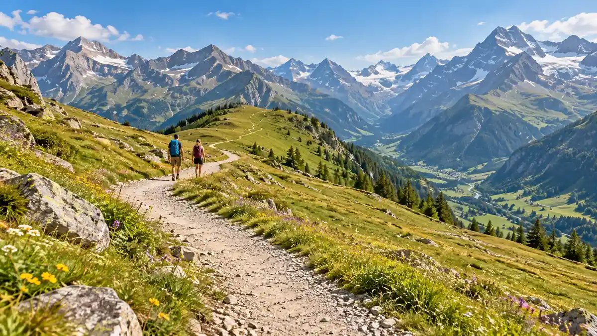
Switzerland grades every trail by signpost colour, and that colour is a better fitness guide than any blog’s “easy” label. Yellow marks a hiking trail anyone in decent shoes can walk. White-red-white marks a mountain trail that needs sure footing. White-blue-white marks an alpine route, which is beyond a day-hiking visitor.
According to SwitzerlandMobility, the country has about 65,000 km (roughly 40,000 miles) of waymarked trails, and the same colour code runs across all of them. Learn it once. Every signpost in the country then doubles as a fitness check.
- Yellow signposts (Wanderweg, or hiking trail): suit anyone with decent shoes and ordinary fitness. The tradeoff is that the biggest views often sit just above the point where yellow ends.
- Yellow signposts with white-red-white tips (Bergweg, or mountain trail): suit sure-footed walkers with a head for heights. Expect steep, narrow and sometimes exposed sections that call for proper hiking boots.
- Blue signposts with white-blue-white tips (alpine route): suit experienced mountaineers only. Snowfields, scree and short climbing passages are part of the grade, and no pick on this page asks for it.
Pink signposts mark winter hiking trails. The colours also map onto the Swiss Alpine Club’s T1–T6 scale, which grades individual routes in finer steps. For a visitor choosing a day hike, the signpost colour does the job on its own.
Published hiking times on Swiss signposts make no allowance for breaks. Add your own margin for lunch, photos and slower going on steep ground.
The colour on a Swiss signpost is set by the people who maintain that trail; the word “easy” on a blog was chosen by whoever wrote the post. When the two disagree, trust the signpost.
Bernese Oberland and Valais: Oeschinensee and the Aletsch Glacier
Oeschinensee and the Aletsch Glacier panorama are the strongest day hikes in Switzerland outside Zermatt and the Jungfrau. Oeschinensee puts a turquoise mountain lake within easy walking distance of a gondola. The Aletsch walk follows a lift-served ridge above the longest glacier in the Alps. Together they cover the easy and demanding ends of the scale.
Oeschinensee: the easiest big-mountain lake in Switzerland
Base and lift: Kandersteg, Oeschinensee gondola · Effort: a short walk to the lake, or a half-day loop above it · Terrain: broad lakeside path, with a steeper panorama trail higher up
Oeschinensee is the easiest way to stand beside a big alpine lake ringed by cliffs. From the gondola’s top station, a broad path leads gently down to the shore. Walkers with more energy can climb onto the panorama trail along the slope above the lake for the classic high view of the water.
What sets it apart from the other picks is the ratio of effort to scenery. No other walk on this page delivers a lake this dramatic for so little climbing. The tradeoff is crowds. On fine summer days the shore fills up, and the higher panorama trail is steeper and narrower than the lakeside path below it.
Pick this if: you want one postcard alpine lake with children or first-time hikers in tow.
Aletsch Glacier panorama: the hike for a full day above the ice
Base and lift: Fiesch, Bettmeralp or Riederalp, with cable cars up to the ridge · Effort: a full day · Terrain: high, rocky ridge with mountain-trail sections and snow possible into early summer
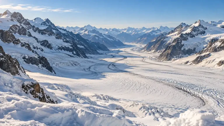
The Aletsch Glacier panorama is the full-day pick, a high route along the ridge that looks straight down onto the Great Aletsch Glacier. The car-free villages of Bettmeralp and Riederalp, and Fiesch lower in the valley, all have lifts to the ridge. The climbing is done before you start walking.
Its distinction is scale. The ice runs out of sight below you for most of the day, a view nothing else on this page matches. The cost is commitment: sections are rocky, narrow and exposed in places, high stretches can hold snow into summer, and bad weather is harder to wait out on an open ridge.
Pick this if: you are a fit, sure-footed walker ready to give a whole day to one landscape.
Tours and activities
Book skip-the-line tickets, day trips and local tours with free cancellation on most activities.
You can also browse everything on getyourguide.com.
Tripstou may earn a commission if you book through this link, at no extra cost to you.
Central Switzerland and Lake Geneva: Rigi and the Lavaux Terraces
Rigi and the Lavaux terraces are the gentlest picks here, each a short train hop from a city. Rigi is the lake-view walk for anyone based in Lucerne or Zurich. Lavaux suits Lausanne and Geneva. Neither needs mountain-trail experience, which makes them the natural choice for mixed-ability groups.
Both bases also work well for a day off walking. If the group wants something other than a trail, the guide to things to do in Switzerland covers the country’s non-hiking options.
Rigi panorama trail: lake views on a mostly level path from Lucerne
Base and lift: Lucerne, Vitznau or Arth-Goldau, with the Rigi railways to the top · Effort: a half day, gentle · Terrain: broad panorama path, mostly level with short gradients
The Rigi panorama trail runs along the mountain’s upper slopes with Lake Lucerne and the Alps laid out below. The cogwheel railways from Vitznau and Arth-Goldau do the climbing. You can walk between stations at the top and ride down from a different one than you came up.
Rigi wins on access. It works as a half day from Lucerne with no early start, and the path is gentle enough for children and older walkers. The limit is drama. The views are wide and lovely, but there is no glacier or high lake, and on clear weekends the summit area gets busy.
Pick this if: you are staying in Lucerne or Zurich and want mountain views on a half day with no hard climbing.
Lavaux vineyard terraces: the walk for a hot day or a rest day
Base and lift: Lausanne, Vevey or Montreux, no lift, local trains between villages · Effort: about 2–3 hours of easy walking · Terrain: vineyard paths and quiet lanes on terraces above the lake
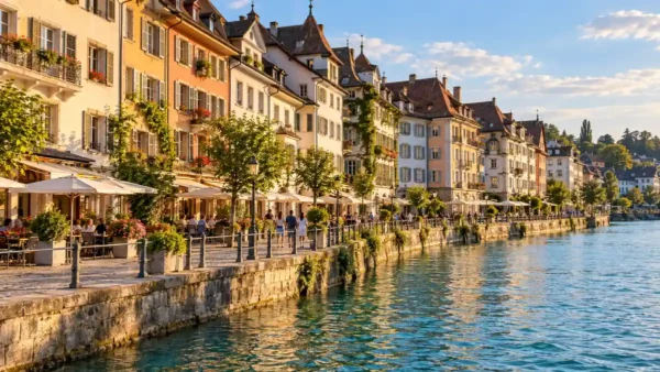
The Lavaux walk follows paths and narrow lanes through the terraced vineyards between Lausanne and Vevey, a UNESCO World Heritage landscape above Lake Geneva. Stations on the lakeside railway let you start, stop or cut the walk short wherever you like, so the length is yours to set.
Lavaux is the pick for when the mountains say no. It sits low, so it stays walkable when high trails are still snowbound or already closing, and wine villages break the route into easy stages. The catch is gradient. Lanes between the terraces climb and drop more than a “lakeside stroll” suggests.
Pick this if: you want an easy walk with wine and lake views on a rest day or while high trails are out of reach.
Eastern Switzerland: the Schäfler Ridge and the Engadin
The Schäfler ridge and Muottas Muragl reward a detour east. The Appenzell pick combines Aescher, a guesthouse built into a cliff face, with an exposed ridge walk above it. The Engadin walk follows a high balcony path above the lakes near St Moritz. Both start from a lift, so the views arrive early.
Schäfler ridge and Aescher: Appenzell’s ridge walk with the famous cliff inn
Base and lift: Wasserauen or Appenzell, Ebenalp cable car · Effort: a half day to the inn, longer to the ridge · Terrain: short path down to the inn, then a steep, exposed mountain trail onto the ridge
From the Ebenalp top station, a short path leads down past the Wildkirchli caves to the Aescher guesthouse, tucked under an overhanging cliff. The longer option climbs from Ebenalp onto the Schäfler ridge, where the peaks of the Alpstein range open up on both sides of the path.
Aescher is one of the most photographed buildings on any Swiss trail, and the inn alone makes the trip for most visitors. The ridge is another matter. It is narrow, steep in places and exposed, a walk for people who already know they are comfortable above drops. The inn is a perfectly good place to turn around.
Pick this if: you want the Aescher cliff-inn view, with a ridge to push on to if you are a confident walker.
Muottas Muragl panorama: the Engadin’s lake-chain balcony walk
Base and lift: St Moritz, Pontresina or Samedan, Muottas Muragl mountain railway · Effort: a half day · Terrain: high balcony path along the slope with modest climbs
The Muottas Muragl panorama path starts at the top of the mountain railway near Samedan and traverses the slope with the Upper Engadin lakes spread out below. It ends on the Pontresina side. You walk across the view the whole way, then descend to the valley.
Its edge over the other picks is altitude without effort. The railway puts you high above the Engadin, and the path keeps you there on mostly gentle ground. Reach is its weakness: it only makes sense if you are already in the Engadin, and the climb to Piz Languard is a separate, far more strenuous extension.
Pick this if: you are already staying in the Engadin and want high-altitude views for modest effort.
Zermatt and the Jungfrau Region: the Signature Hikes in Brief
Zermatt’s Five Lakes and Riffelsee walks, plus the Jungfrau’s Männlichen–Kleine Scheidegg and Bachalpsee walks, are Switzerland’s most photographed hikes. Both regions deserve a trip of their own. Their trails, lifts and bases need more room than a national shortlist allows, so each has a dedicated guide.
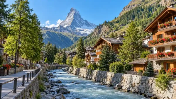
Zermatt suits walkers who want the Matterhorn in frame for most of the day. The Five Lakes Walk is the usual first choice, and the full route list is in the guide to the best hikes in Zermatt.
The Jungfrau region adds Mürren’s panorama trails to Männlichen and Bachalpsee. Its bases and lifts are covered in the Jungfrau region guide. Both regions rely on lifts to reach their best trails. Plan them there.
Easy Hikes in Switzerland for Beginners and Families
Beginners, families and non-hikers can do Oeschinensee’s lakeside path, the Rigi panorama path and the Lavaux terraces without mountain experience. Beyond these, the rule that keeps any walk easy is to stay on yellow-signed trails. Yellow means a maintained hiking path without serious exposure, whatever a blog or a brochure calls it.
A few patterns make almost any Swiss walk easier. The first is to start high: let a gondola or mountain railway do the climb, then walk along or down. Long descents are hard on knees, so riding down is a sensible choice too.
The second is to go point to point. A walk with a lift or station at both ends beats a loop that finishes with a climb, and it lets you stop whenever legs or weather say so.
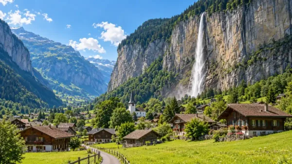
The third is to stay low for non-hikers. Lakeside and valley-floor paths keep the scenery with almost no gradient. Lauterbrunnen-type valleys are the classic example, and the Jungfrau region’s bases and valley walks are covered on the region page.
Signpost times exclude breaks, and children slow down on steep ground. Plan a short first family day. “Easy” is not a Swiss grade, so check the signpost colour at the trailhead before trusting any label.
Which Hike Fits Your Base: Zurich, Lucerne, Interlaken or Geneva?
From Zurich or Lucerne take Rigi; from Interlaken use the Jungfrau or Kandersteg side; from Geneva or Lausanne walk Lavaux. Base beats ambition for a day hike, because hours spent on trains come out of walking time. Brig, Appenzell and St Moritz each have a strong pick of their own.
| Base | Hike | Effort and trail character | Pick this for |
|---|---|---|---|
| Lucerne or Zurich | Rigi panorama trail above Lake Lucerne | Gentle half day on a broad, mostly level path | Mountain views without an early start |
| Interlaken or Bern | Oeschinensee lakeside and panorama trails | Short lakeside walk, steeper panorama loop optional | Families and first-timers wanting one alpine lake |
| Brig or the Aletsch villages | Aletsch Glacier panorama ridge walk | Full day on high, rocky ridge sections | Fit walkers giving a whole day to the glacier |
| Lausanne or Geneva | Lavaux vineyard terraces walk | Easy 2–3 hours on lanes and vineyard paths | A rest day or when high trails close |
| Appenzell or St Gallen | Schäfler ridge and Aescher inn | Short walk to the inn, exposed ridge beyond | The cliff-inn view, ridge for confident walkers |
| St Moritz | Muottas Muragl panorama balcony path | Half day on a high balcony path | Big Engadin views for modest effort |
Choosing a base for the whole trip is a separate decision, and the Switzerland travel guide walks through it. If you are staying in Zermatt, the Zermatt hikes guide has the picks on your doorstep. From Grindelwald, Wengen or Mürren, start with the Jungfrau region guide.
Lavaux is the one pick in this table that needs no lift and no high-trail conditions, which makes Lausanne and Geneva the safest bases for an early- or late-season trip.
Weather, Season and Safety Basics on Swiss Trails
The Swiss hiking season runs roughly mid-June to mid-October; the highest trails are reliably clear around July to September. Within that window, three habits keep a day hike safe: build in time beyond the posted times, turn back early when clouds build, and stay on the trail colour you are rated for.
Low walks such as Lavaux stay walkable well beyond that window. High trails can stay snowbound into summer, so an early-season Aletsch or Schäfler plan needs a conditions check first. Lifts to trailheads run on their own seasons. Month-by-month timing and lift seasons are in the guide to the best time to visit Switzerland.
Pad the posted times for stops, photos and slower going on steep ground, and note when the last lift down leaves before you set off.
Mountain weather changes fast. Start early, watch the sky, and turn around at the first real sign of a change. A yellow trail that meets a white-red-white section has become a mountain trail from that point, and the higher grade applies.
On an exposed route like the Schäfler ridge, turn back while the sky is still clear enough to show you the way down. Waiting for certainty usually means waiting too long.
Frequently Asked Questions
Do you need hiking boots for Swiss mountain trails?
On white-red-white mountain trails, yes: steep, narrow and rocky sections call for proper hiking boots with ankle support and good grip. On yellow hiking trails, sturdy walking or trail shoes are usually enough in dry weather. Wet grass, snow patches and long descents change that, so pack boots if your plan includes any higher ground.
Can you hike in Switzerland in May or October?
Yes, but mostly at lower altitude. May falls before the main hiking season, when high trails can still be snowbound, and the season winds down from mid-October. Low routes such as the Lavaux vineyard terraces stay walkable in both months, so plan lake and valley walks and check trail and lift conditions before any higher route.
Do you need to book Swiss hikes in advance?
No. Swiss hiking trails are open to everyone without a permit or reservation, so a day hike can be chosen the evening before, once you have seen the forecast. Advance booking matters mainly for overnight stays in mountain huts in high summer. For a day hike, the useful check is whether the lift to the trailhead is running.
Is it safe to hike alone in Switzerland as a beginner?
Yes, on yellow-signed hiking trails in good weather, which are maintained, well signposted and, on popular routes, busy in summer. Tell someone your route and expected return, start early, and carry water, a charged phone and a warm layer. Leave white-red-white mountain trails and exposed ridges such as the Schäfler for days with company or more experience.
What are the best multi-day hikes in Switzerland?
The best-known multi-day routes are Switzerland’s national long-distance trails, among them the Via Alpina, the Jura Crest Trail and the Alpine Passes Trail. Each links villages and overnight stops over several days and needs its own planning for stages and beds. This guide sticks to day hikes that start and finish near a lift, train or lakeside village.
Is Oeschinensee or the Aletsch Glacier the better first hike?
Oeschinensee is the better first hike for most visitors. The gondola and a broad path put you at the lakeshore with little climbing, so it suits mixed groups and uncertain weather. Choose the Aletsch Glacier panorama instead if you are fit, sure-footed and have a clear day to give entirely to one high, exposed ridge.
Related Guides
- Best hikes in Zermatt: the Five Lakes Walk, Riffelsee and the rest of Zermatt’s trails, with lifts and timing.
- Jungfrau region guide: bases, lifts and the Männlichen, Bachalpsee and Mürren walks in one place.
- Best time to visit Switzerland: month-by-month conditions and when the lifts to trailheads run.
- Things to do in Switzerland: the non-hiking options for rest days and mixed groups.
- Switzerland travel guide: the trip overview, including how to choose a base for the whole stay.
Did this guide save you time or money? Tripstou is independent and reader-funded — if you'd like to give something back, you can support the site with a crypto contribution of any size.